SWISS-DRONEMAP.CH
beta
Map
App
DABS
Info
About
🇨🇭
EN
English
Deutsch
Français
Italiano
Swiss Drone Map App
The Ultimate Mobile Companion for Swiss Drone Pilots
LAUNCH INTERACTIVE DRONE MAP
Get the ad-free mobile app
The 'Swiss Drone Map' app is all you need to plan your drone flight in Switzerland and manage your documents.
Available for Android and iOS in English, German, French, and Italian.
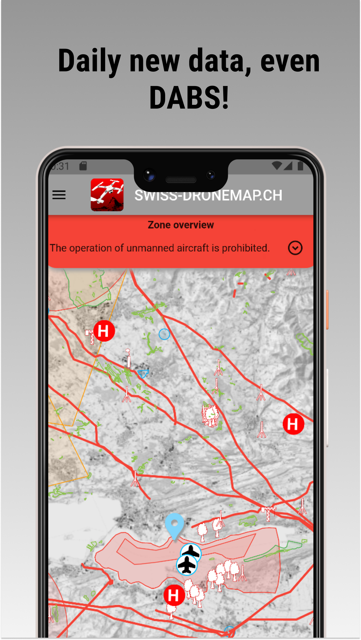
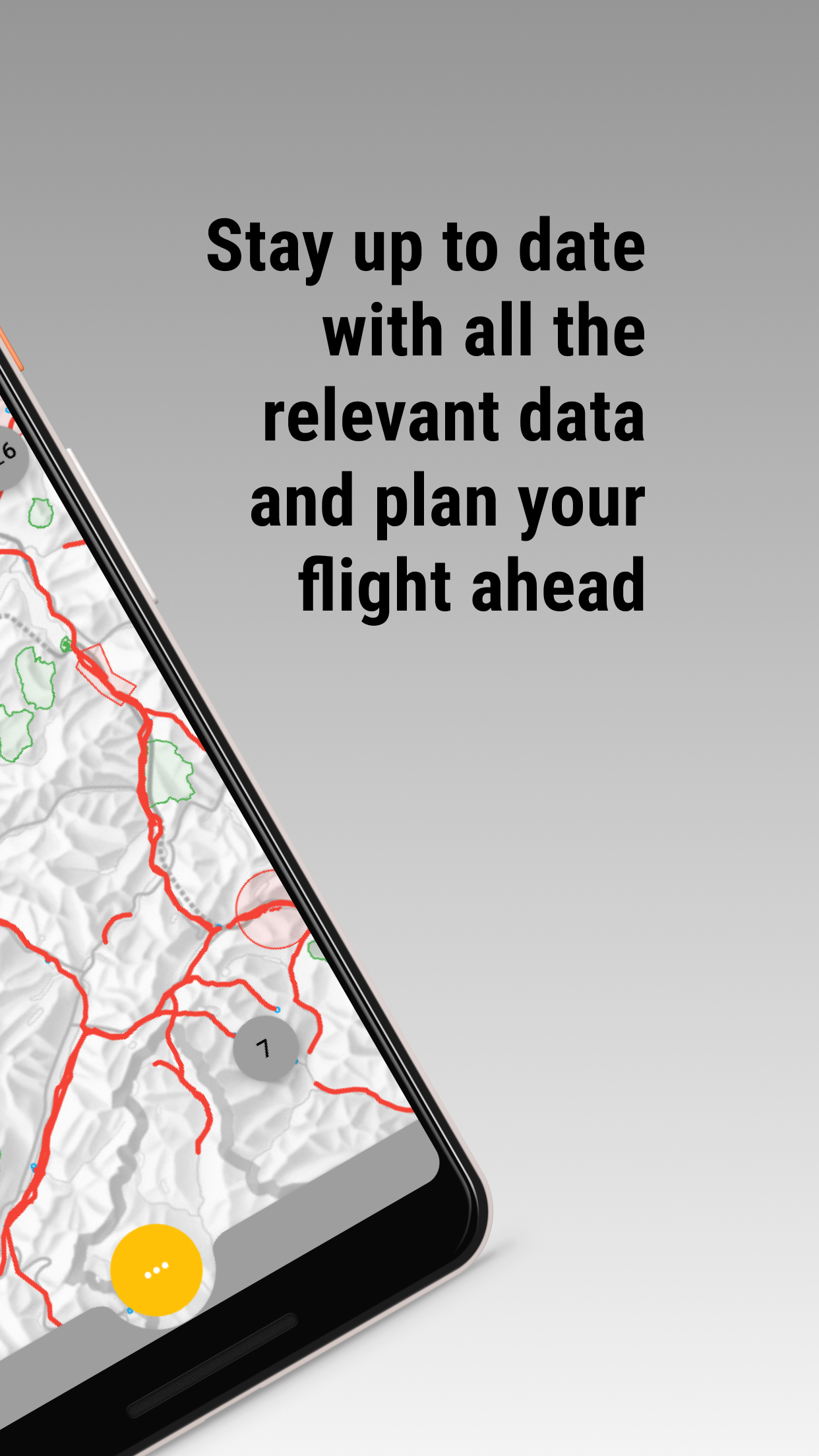
Flight relevant data is updated daily.
NOTAM/DABS data is updated hourly.
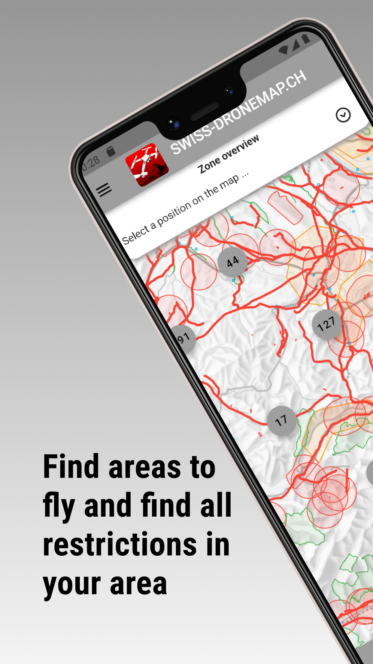
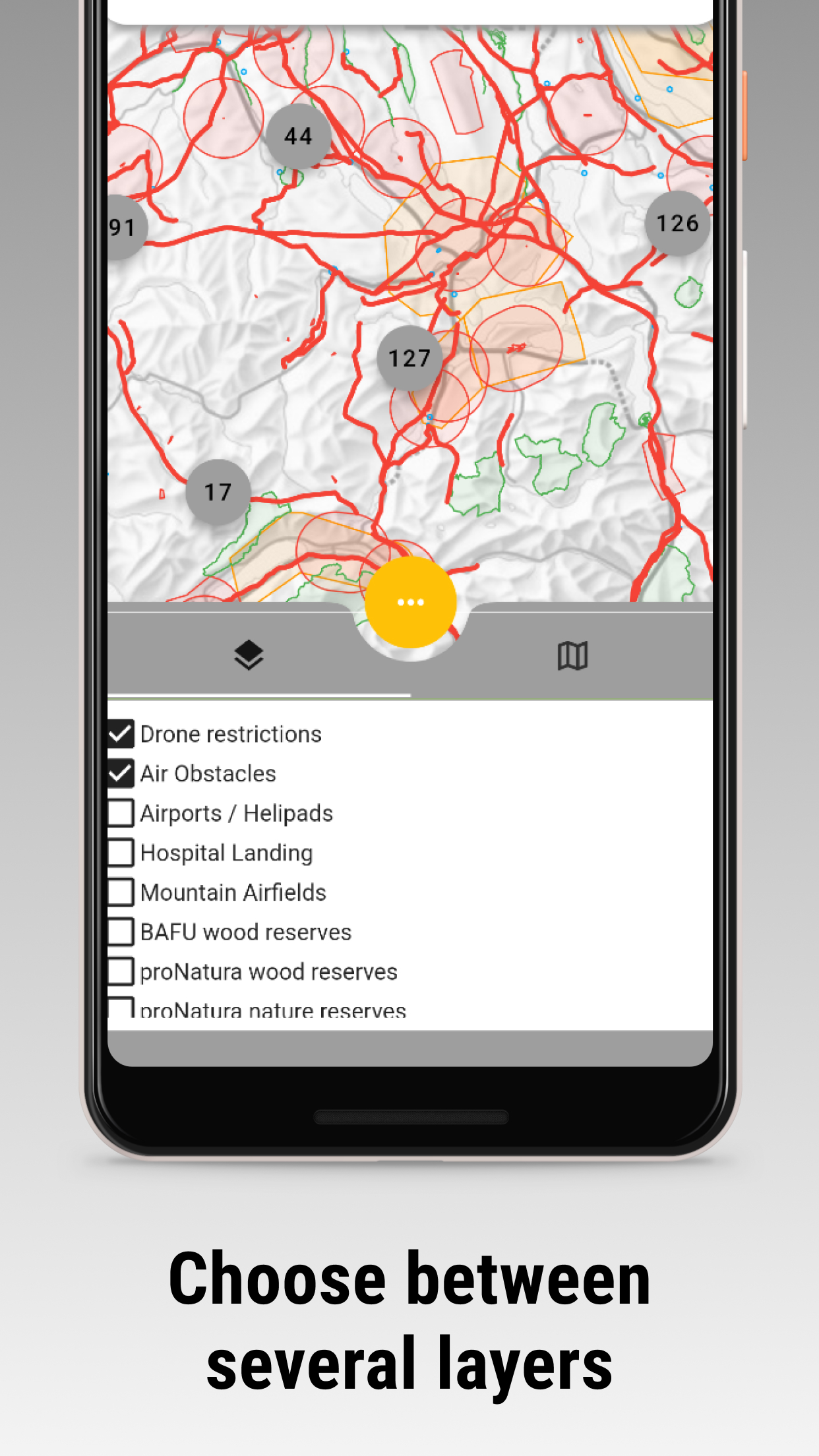
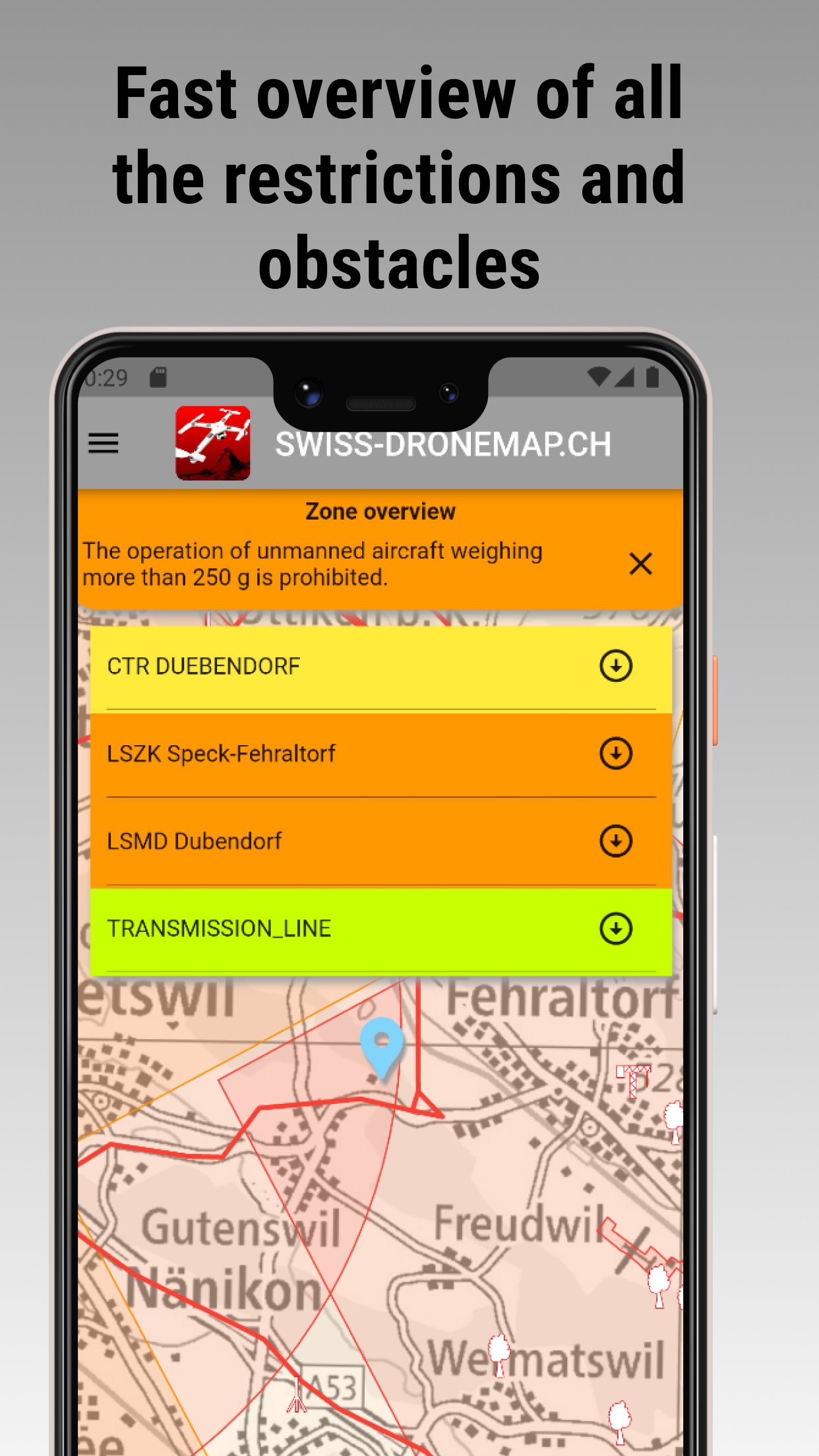
Comprehensive layers to help you plan your flight:
Live flight tracking (ADSB/FLARM)
NOTAM/DABS today & tomorrow
Drone Restrictions & No-Fly Zones
Aviation Obstacles
Easy Fly Zones (30m & 150m buffers)
Airfields, Heliports, Hospital Landing Sites
Nature Reserves
Parking Spots
7 different base map styles available.
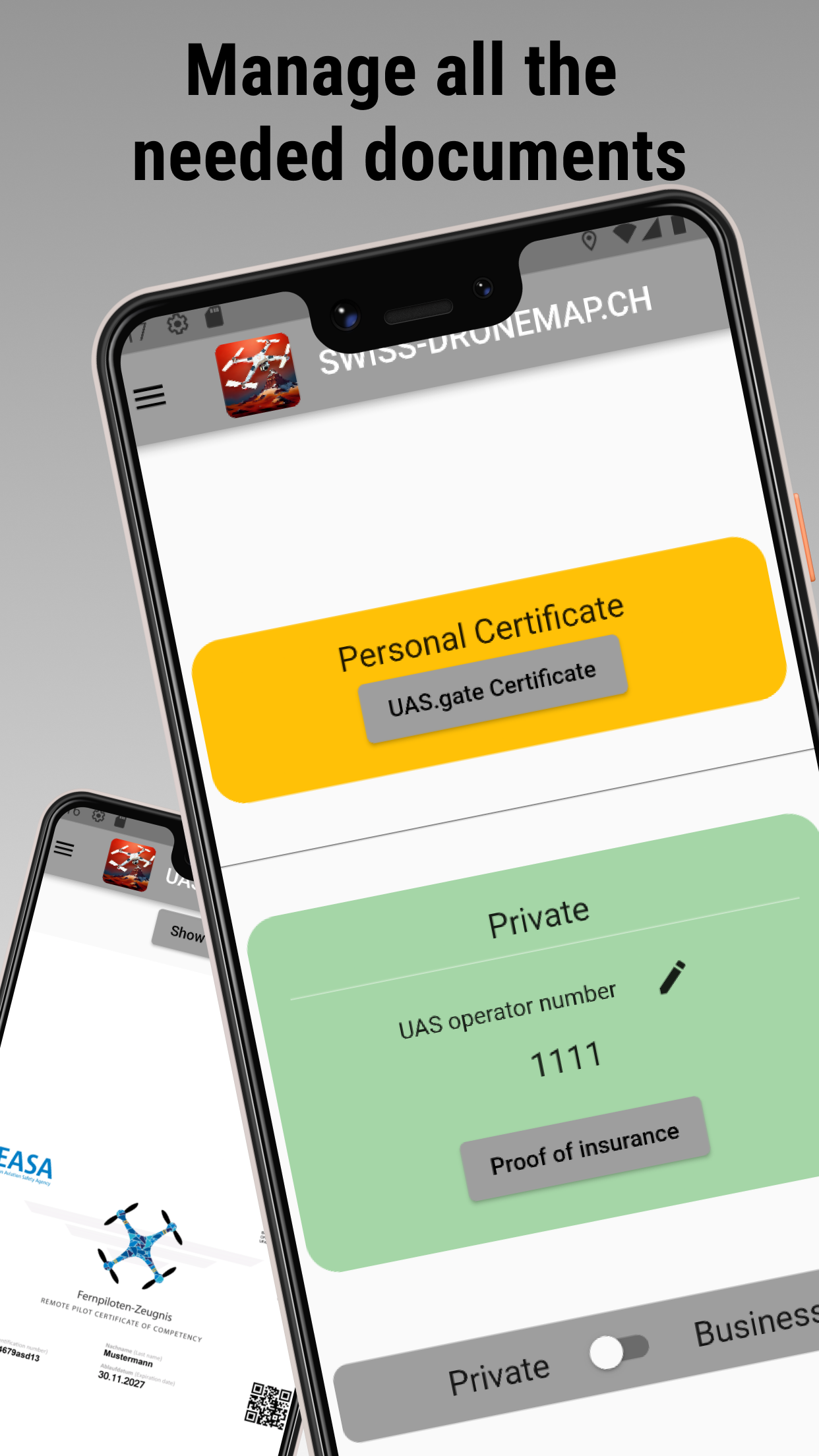
Manage your drone documents digitally.
Add documents for private and business use.
Supported documents:
A1/A3 Competency Proof (UAS.gate/EASA)
A2 Remote Pilot Certificate
UAS Operator Number
Insurance Proof
QR-code extraction for easy inspection.
Get the ad-free mobile app